
It’s a bit tough being in Israel right now. But fortunately we have Waze (the navigation app developed in Israel and sold to Google) to help us navigate and report incidents on the road.
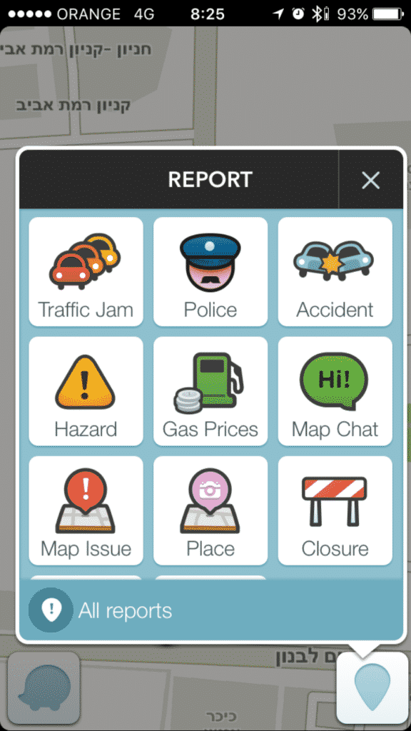
This is the real reporting screen:
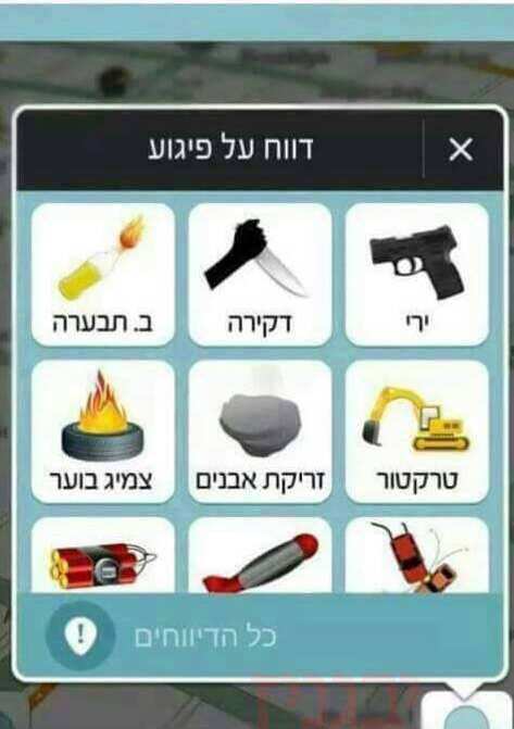
And this is how it probably should look:
But what you probably don’t know, and this is the real Waze, is that we have this option in Israel:
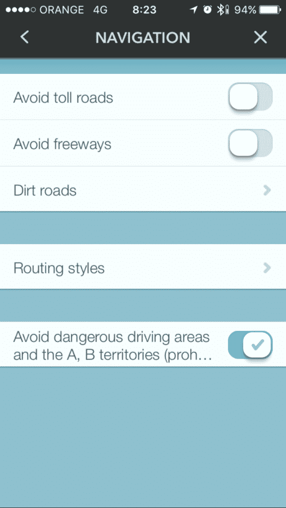
This setting, however, unless it has changed since this report in August, is still not good enough to direct complete outsiders around some parts of Jerusalem today:
This feature can sometimes delay a trip by 20 minutes or more. A drive from The First Station in Jerualem to the City of David in Jerusalem, less than a kilometer’s distance as the crow flies, will take more than half an hour using Waze directions.
This is because the application designates the Silwan area as controlled by the Palestinian Authority. Otherwise, the trip would last about 10 minutes.
Similarly the app will direct those going from Mount Scopus to the Kotel to go through At-Tur and not through Wadi Joz, defined as PA territory. This is so despite the fact that the frequency of terrorist incidents in the neighborhood of At-Tur are much higher than that of Wadi Joz.
Following Ynet’s report on the subject, Nir Barkat, the Mayor of Jerusalem, said he intends to contact the CEO of Waze to demand this setting be changed.
 And lets face it, if Nir Barkat demands something, you’re going to take him seriously right?
However, that setting will still send you on the road 443 from Jerusalem to Tel Aviv (via Modiin) which does, for a few KM, drive near some Arab villages in Judea and subsequently goes through a security check point before getting back on the main Jerusalem Tel Aviv highway. In fact it was Waze, many years ago, that first told me of 443.
On Wednesday night I chose to ignore Waze, which wanted me to use 443, and use Highway 1. Highway 1 is currently undergoing massive works to increase it to three lanes for its entire length so it’s a bit of a lottery at night as to whether they will block one or sometimes even both of the two lanes. I’ve been stuck there for 20 minutes on one occasion.
But I just didn’t want to use 443.
Last night drivers on 443 came under serious rock Jihad with windshields shattered and minor injuries.
https://twitter.com/ILNewsFlash/status/652195568429703169
Stay vigilant everyone.